Denna text om den tropiska cyklonen Phanfon skrev jag på engelska tidigare idag. Hoppas ni har överseende med det.
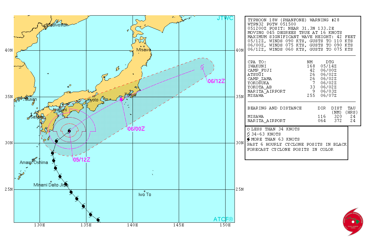
Typhoon Phanfone is pounding Japan with strong winds and intense rain as a category-2 typhoon. The typhoon is weakening as it has entered colder water, but it will still be a category-1 typhoon and will continue to be so as it affects southern Japan during sunday and monday.
 Graphics: Joint Typhoon Warning Center via Hurricanezone.
During its journey it has now started to accelerate on a north-easterly direction and will eventually merge with a baroclinic zone, i.e. transform to a very deep low-pressure with adjoining strong winds and precipitation.
Wind gust speeds up to 45 m/s was recorded at North Daitō Island before the observation station broke or went off-line. Another observation site, Minami-daitō, set an all-time calendar-day record with 217 mm of rain.
Most locations in Japan will be affected one way or another from the typhoon. At monday noon local time (early monday morning European time) Phanfone will be centred over Tokyo.
In cities there will be strong winds an possibly injuries and damages from loose objects tumbling around in the wind. But the main threat comes from torrential rain which may cause flash flooding and mud slides. As much as 100-200 mm of rain is expected over large areas of Japan.
/Martin Hedberg
